

WINSLOW — It’s official: big things are planned for the historic Fort Halifax Park.
The Winslow Town Council voted unanimously Monday night to approve a Fort Halifax Park concept master plan, which calls for new parking lots, short walking trails, boat launches, an overlook, educational signs, displays in the historic blockhouse and an outline depicting the boundaries of the original fort.
Additional Photos
Now, the town must decide how much money will be spent on planned projects, which are expected to take several years to complete.
“This community has had a vision for that park for many, many years, but has never put on paper a vision,” said Town Manager Michael Heavener. “I think the potential there is enormous.”
At the advice of Heavener, councilors also voted to reconvene as many members as possible of the volunteer group that spent the last year devising the master plan. The group would now be called the Fort Halifax Implementation Committee and its purpose would be to create “a detailed, phased construction plan with cost estimates based on the concept master plan,” Heavener said.
Prior to the vote, councilors praised the work of the Fort Halifax Park Planning Committee.
“It’s a beautiful plan,” said councilor Roland Michaud. “I can’t see anything but good coming out of this thing.”
Even so, Michaud conceded, “money’s another thing.” Heavener also recommended that the town partner with another group, Friends of Fort Halifax, to devise fundraising strategy to pay for park improvements.
The park planning committee reviewed six previous studies dating back more than 30 years and blended goals of history and education, land preservation and recreation. Town Councilor Ray Caron, chairman of the park group, calls the group’s plan as a compromise that attempts to balance those goals.
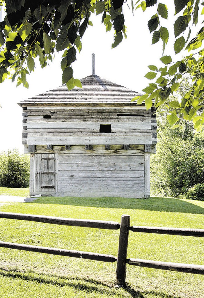
Fort Halifax was established there in 1754-55, during the Seven Years’ War between the English and French. The area, which is a National Historic Landmark, is bordered by the Kennebec and Sebasticook rivers.
The state of Maine acquired ownership of the historic blockhouse in 1966, but the flood of 1987 swept the blockhouse down the Kennebec River and it had to be reconstructed.
The new master plan proposes to give visitors a sense of the original fort’s size with the installation of an 8-foot-high stockade fence on a portion of the fort’s original boundary, connected to the existing blockhouse. Posts and educational signs would indicate the remainder of the fort’s original outline, which includes the locations of a barracks and a trading post.
To build the historical display, the existing parking lot will be reconfigured and moved, because it’s covering the outline of the original fort. The lot would be moved west and broken up into three distinct sections, one for bus parking near the blockhouse, one near the entrance and J&S Oil, and another projecting out into the park. There, two short walking paths are proposed, one leading to a boat launch at the shore and another east to a new overlook for open views up and down the river.
In addition, town officials will need to get Pan Am Railways to agree to relocate its railroad crossing at the park, to accommodate the proposed parking lot design. Caron said Monday the parking lot relocation will likely be among the first projects the committee investigates.
Other proposed changes include new landscaping with trees and riverbank stabilization, a new canoe and kayak launch area on the southern shore, and new picnic tables and signs.
“It is important to note,” Heavener wrote in a memo to the council, “that it could take many years to fully implement a phased plan, which is why having a plan is so important.”
Scott Monroe — 861-9239
smonroe@centralmaine.com
Send questions/comments to the editors.

Success. Please wait for the page to reload. If the page does not reload within 5 seconds, please refresh the page.
Enter your email and password to access comments.
Hi, to comment on stories you must . This profile is in addition to your subscription and website login.
Already have a commenting profile? .
Invalid username/password.
Please check your email to confirm and complete your registration.
Only subscribers are eligible to post comments. Please subscribe or login first for digital access. Here’s why.
Use the form below to reset your password. When you've submitted your account email, we will send an email with a reset code.